What Is a Watershed?
A watershed, also known as a drainage basin, is an area of land in which all water that falls on the land drains into a common waterway, such as a stream or river. The topography of the landscape determines watershed boundaries because all water naturally flows downhill. Water can take many forms for each of these common destinations. Watersheds can vary in size. We all live in a watershed and live downstream of a watershed, so it is important to remember that what we do on land affects water quality for all communities.
What Watershed Do I Live In?
 In Pennsylvania there are 6 dominant watersheds; Ohio, Susquehanna, Delaware, Potomac, Genesee, and Erie Western Pennsylvania is split by the Allegheny Front which is the eastern continental divide that separates our major watersheds from those of the east and west. Water flowing west drains into the Mississippi River eventually to the Gulf of Mexico. Water flowing to the east drains into the Chesapeake Bay eventually leading to the Atlantic Ocean.
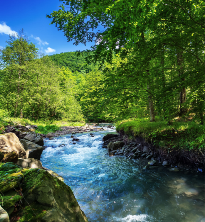
Blair County is almost completely contained within the Juniata River Watershed. The Juniata River Watershed is located in southcentral Pennsylvania, encompassing 3,400 square miles to include all or parts of Bedford, Blair, Cambria, Centre, Franklin, Fulton, Huntingdon, Juniata, Mifflin, Perry, Snyder, and Somerset Counties. The watershed is bordered by the West branch of the Susquehanna on the north, and The Ohio River to the west.
The main stem of the Juniata river forms at the confluence of two major tributaries: the Frankstown Brach of the Juniata River and the Little Juniata River. The Raystown Branch, the third major tributary to the Juniata River, joins the main stem a few miles downstream of its origins. The Raystown Branch is the largest tributary of the Juniata River at 120 miles long and drains 964 square miles of rough mountainous country. The Frankstown Branch is 45 miles long and drains 396 square miles. The Little Juniata is 32 miles long and drains 342 square miles. The main stem of the Juniata River is over 100 miles long and empties into the Susquehanna River near Duncannon, PA. Other major tributaries include Aughwick Creek, Kishacoquillas Creek, Standing Stone Creek, and Tuscarora Creek. There are also over 400 named streams that make up the river basin drainage area, for a total of 6,560 total stream miles.
To find additional information and what watershed you live in visit “How’s My Waterway” at epa.gov.
Restoration Efforts
The Blair County Conservation District, in cooperation with the Blair County Intergovernmental Stormwater Committee (ISC), received a grant from the National Fish and Wildlife Foundation to develop a plan to improve urban stormwater management. Work through this grant allowed for restoration and enhancement opportunities as well as assessments of potential impacts on streams during storm events. To learn more about how Blair County is evaluating watershed issues please review the Blair County Baseline and Characterization Report.
As a partner and/or cooperating agency, the District serves as the local contact for projects and practices. We have put together funding packages, initiated the design of treatment and restoration projects, served as the contract administrator for projects, and much more. The District has achieved restoration efforts through the completion of watershed plans and assessments as well as the implementation of projects.
Volunteer Stream Monitoring Network
In 2011, The District developed the Blair County Volunteer Stream Monitoring Network as a way to collect baseline water quality data on our local streams. This program originated as a Pennsylvania Senior Environmental Corps (PA SEC) program but has since expanded to include concerned citizens of all ages. Currently, our team of 20 volunteers are monitoring 14 streams across the county to aid the District in recoding baseline stream quality information for our watersheds.
The Volunteer Stream Monitoring Network is a group of volunteers interested in protecting Blair County’s high-quality water resources. Volunteers are out in the field monthly and collect information on streamflow, water chemistry (such as pH, nitrates, dissolved oxygen, etc.), macroinvertebrates (stream bugs), as well as conduct habitat assessments. The District provides support through program administration, training, and equipment/supplies. Volunteers need to have no professional training and may have varied backgrounds from manufacturing, sales, academia, to students.
If you would be interested in leaning more about the Monitoring Network or in becoming a volunteer, please contact the District for more information.